Modelling and Inversion
CMTS generates the highest quality Earth conductivity models in 1-, 2-, or 3-dimensional space from magnetotelluric data.
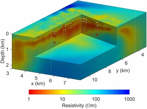
The 3D inversion algorithm has been employed in many academic and industry projects. The novel 3-D inversion code, unique to CMTS, handles topography, distortion from near-surface small-scale inhomogeneities, and data acquired by distributed array systems, and can be modified to suit specific needs. The 3D inversion code can now handle magnetotlluric (MT) Z-axis tipper electromagnetic (ZTEM) and mobile magnetotelluric (MMT) data, separately and simultaneously.